
Surveyors from Ordnance Survey have officially marked the new Everton Stadium on the map.
Everton Stadium has officially been placed on the map after hosting its first-ever match, where the club’s Under-18s faced Wigan Athletic. This game marked the first of three test events before the stadium can operate at full capacity, welcoming 52,888 fans.
Surveyors from Ordnance Survey (OS), responsible for the National Geographic Database, have been closely tracking the stadium’s development for years. Built on reclaimed land, the site required meticulous mapping, including aerial surveys via planes and drones, to capture its transformation from Bramley-Moore Dock into a state-of-the-art football ground.
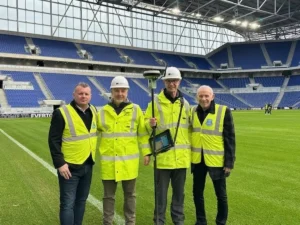
More recently, field surveyors gathered final details on the ground, including pitch dimensions and emergency access points. On Monday, following a live broadcast from BBC Breakfast at the stadium, Everton Stadium’s name was officially added to OS’s digital maps. It will also appear in future paper map editions.
To mark the occasion, club legends Graham Stuart and Peter Reid joined representatives from the 1878s Supporters Group. Paul Cruddace, Head of Production at OS, emphasized the significance of this moment, stating that mapping the stadium is a “great honor” given Everton’s deep-rooted football history and impact on the city of Liverpool.
OS plays a crucial role in mapping Britain’s evolving landscape, using advanced 3D imaging to keep maps accurate. Mapping a venue as significant as Everton Stadium ensures smooth navigation for fans, staff, and service providers. The area includes public transport links, as well as bars, restaurants, and retail spaces, all carefully documented by surveyors to support the stadium’s long-term operations.
Leave a Reply